


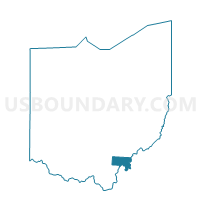
NORTH OLIVE Voting District, Meigs County, Ohio
About
Outline

Summary
| Unique Area Identifier | 649977 |
| Name | NORTH OLIVE Voting District |
| County | Meigs County |
| State | Ohio |
| Area (square miles) | 15.63 |
| Land Area (square miles) | 15.60 |
| Water Area (square miles) | 0.03 |
| % of Land Area | 99.81 |
| % of Water Area | 0.19 |
| Latitude of the Internal Point | 39.14870560 |
| Longtitude of the Internal Point | -81.81916950 |
Maps


Graphs
Select a template below for downloading or customizing gragh for NORTH OLIVE Voting District, Meigs County, Ohio


Neighbors
Neighoring Voting District (by Name) Neighboring Voting District on the Map
- Voting District CARTHAGE TOWNSHIP, Athens County, OH
- EAST CHESTER Voting District, Meigs County, OH
- ORANGE Voting District, Meigs County, OH
- SOUTH OLIVE Voting District, Meigs County, OH
- Voting District TROY WEST, Athens County, OH
Top 10 Neighboring County Subdivision (by Population) Neighboring County Subdivision on the Map
- Troy township, Athens County, OH (2,617)
- Chester township, Meigs County, OH (2,496)
- Olive township, Meigs County, OH (1,798)
- Carthage township, Athens County, OH (1,532)
- Orange township, Meigs County, OH (1,072)